Documents
This section features public documents and files uploaded by the stakeholders and custodians of the Caspian Sea environment.
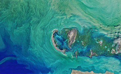
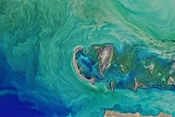
 Колебания уровня каспийского моря и диагностика современных изменений положения береговой линии по спутниковым данным Landsat периода 2005…2015 годовThu, 09/08/2018 - 13:45Рассмотрены вопросы, связанные с проблемой колебаний уровня Каспийского моря и их влияний на прибрежную зону казах-станского сектора. По данным картирования спутниковых снимков площадь осушения в северо-восточной части Каспийского моря в период между 2005 и 2015 гг. составила 5055 км2. В некоторых районах море отступило на 2
- Description
Рассмотрены вопросы, связанные с проблемой колебаний уровня Каспийского моря и их влияний на прибрежную зону казах-станского сектора. По данным картирования спутниковых снимков площадь осушения в северо-восточной части Каспийского моря в период между 2005 и 2015 гг. составила 5055 км2. В некоторых районах море отступило на 25 км
- Attached documents
- Metadata
- Year
- 2015
 Recent Oil Spill Preparedness Developments in the Caspian Sea RegionMon, 23/04/2018 - 19:12Natural seeps and easily exploited surface deposits of crude oil on land have been utilized in the Caspian Sea region earlier than 300 BC. The modern-day picture is a region with oil reserves of global importance, facing a key challenge of the transportation of crude oil to markets. There has been considerable focus on devel
- Description
Natural seeps and easily exploited surface deposits of crude oil on land have been utilized in the Caspian Sea region earlier than 300 BC. The modern-day picture is a region with oil reserves of global importance, facing a key challenge of the transportation of crude oil to markets. There has been considerable focus on developing oil spill preparedness in the Caspian Sea region. This has involved the governments, regional bodies, the oil industry and a range of other stakeholders and international organizations (notably UNEP, IMO and OSCE). This effort is in addition to the primary focus on preventing spills.
Countries are developing and implementing National Contingency Plans in order to have effective national response systems, which also act as the basis for regional cooperation.
- Attached documents
- Metadata
- Year
- 2015
Document
Колебания уровня каспийского моря и диагностика современных изменений положения береговой линии по спутниковым данным Landsat периода 2005…2015 годов
Document