Documents
This section features public documents and files uploaded by the stakeholders and custodians of the Caspian Sea environment.
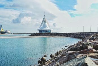
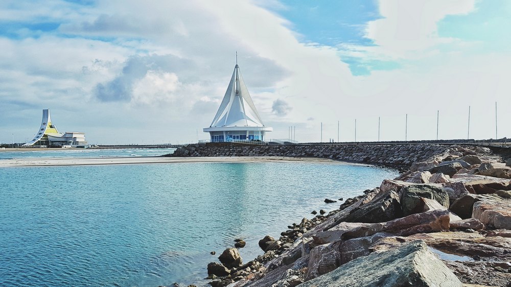
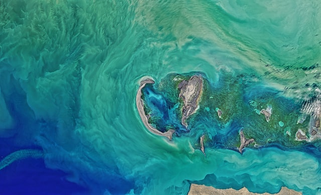
 Caspian Sea Region: Environmental IssuesSat, 21/12/2024 - 16:01At the meeting point of the Middle East, Europe, and Asia, the Caspian region includes steppe land in the north, cold, continental deserts and semi-deserts in the northeast and east, and warmer mountain and highland systems in the south and southwest. The coastal wetlands of the Caspian basin include many shallow, saline poo
- Description
At the meeting point of the Middle East, Europe, and Asia, the Caspian region includes steppe land in the north, cold, continental deserts and semi-deserts in the northeast and east, and warmer mountain and highland systems in the south and southwest. The coastal wetlands of the Caspian basin include many shallow, saline pools, which attract a variety of bird life and biodiversity; over 400 species are unique to the Caspian. In addition, the sea's native sturgeon is famous the world around for the roe it produces: sturgeon from the Caspian Sea accounts for approximately 90% of the world's caviar industry.
- Attached documents
- Metadata
- Year
- 2003
 Колебания уровня каспийского моря и диагностика современных изменений положения береговой линии по спутниковым данным Landsat периода 2005…2015 годовThu, 09/08/2018 - 13:45Рассмотрены вопросы, связанные с проблемой колебаний уровня Каспийского моря и их влияний на прибрежную зону казах-станского сектора. По данным картирования спутниковых снимков площадь осушения в северо-восточной части Каспийского моря в период между 2005 и 2015 гг. составила 5055 км2. В некоторых районах море отступило на 2
- Description
Рассмотрены вопросы, связанные с проблемой колебаний уровня Каспийского моря и их влияний на прибрежную зону казах-станского сектора. По данным картирования спутниковых снимков площадь осушения в северо-восточной части Каспийского моря в период между 2005 и 2015 гг. составила 5055 км2. В некоторых районах море отступило на 25 км
- Attached documents
- Metadata
- Year
- 2015
- Қазіргі таңдағы Каспий теңізінің экологиялық жағдайыThu, 09/08/2018 - 12:52Алматы технологиялық университетінің хабаршысы. 2018. №1.
- Description
Алматы технологиялық университетінің хабаршысы. 2018. №1.
- Attached documents
- Metadata
- Year
- 2018
- Экологическое состояние водной толщи вокруг месторождения КашаганMon, 30/07/2018 - 07:29Исследования, проведенные в летний период 2012 г., показали, что состояние загрязнения водной толщи месторождения Кашаган, расположенного в шельфовой зоне Северного Каспия, до коммерческой добычи нефти находится в пределах возможности самоочищения морской среды.
- Description
Исследования, проведенные в летний период 2012 г., показали, что состояние загрязнения водной толщи месторождения Кашаган, расположенного в шельфовой зоне Северного Каспия, до коммерческой добычи нефти находится в пределах возможности самоочищения морской среды.
- Attached documents
- Metadata
- Year
- 2014
- Каспий және Арал теңіздерінің гидрологиялық режимдерінің өзгерісіMon, 30/07/2018 - 07:25«Еуразиялық интеграция: инновациялық бағдарламаларды жүзеге асырудағы ғылым мен білімнің рөлі» Халықаралық ғылыми-практикалық конференциясының МАТЕРИАЛДАРЫ II Бөлім
- Description
«Еуразиялық интеграция: инновациялық бағдарламаларды жүзеге асырудағы ғылым мен білімнің рөлі» Халықаралық ғылыми-практикалық конференциясының МАТЕРИАЛДАРЫ II Бөлім
- Attached documents
- Metadata
- Year
- 2012
- Об охране, воспроизводстве и использовании животного мираMon, 23/07/2018 - 09:00нормативно-правовой документ Республики Казахстан
- Description
нормативно-правовой документ Республики Казахстан
- Attached documents
- Metadata
- Year
- 2003
 Природные пастбища и развитие отгонного животноводства в ТуркменистанеTue, 10/07/2018 - 10:04Для Туркменистана опустынивание является одной из серьёзнейших экологических и социально-экономических проблем. Каракумы занимают почти всю равнинную территорию Туркменистана и относятся к песчаным пустыням, образованным отложениями древнего речного стока, которые при нерациональном использовании растительного и почвенного п
- Description
Для Туркменистана опустынивание является одной из серьёзнейших экологических и социально-экономических проблем. Каракумы занимают почти всю равнинную территорию Туркменистана и относятся к песчаным пустыням, образованным отложениями древнего речного стока, которые при нерациональном использовании растительного и почвенного покрова легко подвергаются дефляции. Происходит образование барханных песков, которые наносят большой ущерб населённым пунктам, различным инженерным объектам хозяйственного и социально-культурного назначения. Кинга рассказывает о работе, проделанной в стране по выполнению основных положений Конвенции по борьбе с опустыниванием и поиск эффективных способов устойчивого управления пастбищными угодьями, обеспечивающие непрерывное повышение их продуктивности, сокращение площади деградированных участков и увеличение поголовья скота. Данное издание подготовлено и опубликовано в рамках реализации Проекта Адаптационного фонда (АФ), Программы развития ООН (ПРООН) и Государственного комитета Туркменистана по охране окружающей среды и земельным ресурсам «Реагирование на риски, связанные с изменением климата, на систему фермерского хозяйства в Туркменистане на национальном и местном уровнях».
- Attached documents
- Metadata
- Year
- 2018
- "Оценка ледовых условий в казахстанском секторе Каспийского моря"Sun, 08/07/2018 - 22:08отчет Департамента "Зеленой экономики"
- Description
отчет Департамента "Зеленой экономики"
- Metadata
- Year
- 2012
 Caspian Environment Programme - Regional Water Quality Monitoring (2009)Tue, 12/06/2018 - 11:51This Regional Water Quality Monitoring Programme has been developed as part of the project “Caspian Water Quality Monitoring and Action Plan for Areas of Pollution Concern’s (Caspian MAP)”. This project has been financed by the Tacis Programme of the European Union (EU) which amongst others promotes regional co-operation on
- Description
This Regional Water Quality Monitoring Programme has been developed as part of the project “Caspian Water Quality Monitoring and Action Plan for Areas of Pollution Concern’s (Caspian MAP)”. This project has been financed by the Tacis Programme of the European Union (EU) which amongst others promotes regional co-operation on environmental protection. On of the main objectives of the Caspian MAP is to support the Caspian Environment Programme (CEP), which is a partnership between the five littoral states - Azerbaijan, Islamic Republic of Iran, Kazakhstan, Russian Federation and Turkmenistan, and International Partners like EU, UNDP, UNEP, and the World Bank. The CEP's mission is to assist the Caspian littoral states to achieve the goal of environmentally sustainable development and management of the Caspian environment for the sake of long-term benefit for the Caspian inhabitants.
- Attached documents
- Metadata
- Year
- 2009
 Caspian Environment Programme - Regional Pollution Action Plan (2009)Tue, 12/06/2018 - 11:48The Regional Pollution Action Plan for the Caspian Sea (RPAP), has been prepared as part of the project “Caspian Water Quality Monitoring and Action Plan for Areas of Pollution Concern’s (hereafter: Caspian MAP)”. The project is financed by the Tacis Programme of the European Union (EU), which has as one of its objectives th
- Description
The Regional Pollution Action Plan for the Caspian Sea (RPAP), has been prepared as part of the project “Caspian Water Quality Monitoring and Action Plan for Areas of Pollution Concern’s (hereafter: Caspian MAP)”. The project is financed by the Tacis Programme of the European Union (EU), which has as one of its objectives the promotion of regional co-operation on environmental protection. The overall objective of the Caspian MAP is to achieve improved quality of the marine and coastal environment of the Caspian Sea. In particular, the RPAP (current Report) provides recommendations to regional strategies for pollution reduction, with a focus on the identified Areas of Pollution Concern. The Caspian MAP also developed a proposal for a Regional Water Quality Monitoring Program.
- Attached documents
- Metadata
- Year
- 2009
 Caspian Environment Programme - Contaminants from Terek River into Caspian Sea (2007)Tue, 12/06/2018 - 11:43In the frame of the current Project the estimation on contents of nutrients, petroleum hydrocarbons, phenols and heavy metals in water and bottom sediments in the basins of rivers Terek, Sulak and Samur over the last years was carried out. Research was conducted within a framework of the State Monitoring Programme on Roshydr
- Description
In the frame of the current Project the estimation on contents of nutrients, petroleum hydrocarbons, phenols and heavy metals in water and bottom sediments in the basins of rivers Terek, Sulak and Samur over the last years was carried out. Research was conducted within a framework of the State Monitoring Programme on Roshydromet in the central and lower parts of the Terek delta. The data of Roshydromet standard investigations was used to assess the concentration of pollutants, namely petroleum hydrocarbons, heavy metals, phenols, detergents, nutrients (nitrites, nitrates, ammonium and total nitrogen) and silicates, and also expenditure of river water during the estimation of their flows at hydrological Karagalinsky hydro system and
Alikazgan stations in the Terek delta. The Roshydromet data cover the period 2002-2005.- Attached documents
- Metadata
- Year
- 2007
 Caspian Environmental Programme - Study and Survey Project to Determine the Fluxes of Major Contaminants from the Kura to Caspian Sea (2005)Tue, 12/06/2018 - 11:39The Ministry of Environment and Natural Resources of Azerbaijan and Caspian Environment Programme by supporting of UNDP agreed with NGO "Ruzgyar" to organize of 1st professional level monitoring of POPs in Kura-Araks basin till Caspian Sea. "Ruzgyar" contracted professional environmental research company "Azecolab" to implem
- Description
The Ministry of Environment and Natural Resources of Azerbaijan and Caspian Environment Programme by supporting of UNDP agreed with NGO "Ruzgyar" to organize of 1st professional level monitoring of POPs in Kura-Araks basin till Caspian Sea. "Ruzgyar" contracted professional environmental research company "Azecolab" to implement of standard sampling and lab analytical processes.
- Attached documents
- Metadata
- Year
- 2005
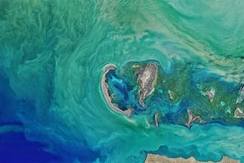
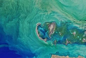
 Map of Caspian River BasinTue, 05/06/2018 - 12:07Map of the Caspian River Basin. Produced by Manana Kurtrubadze
- Description
Map of the Caspian River Basin.
Produced by Manana Kurtrubadze
- Attached documents
- Metadata
- Year
- 2018
 Article - Review of pollution sources and controls in Caspian Sea regionMon, 23/04/2018 - 18:24Daily extractions of crude oil and gas and transportation of them are the main pollution sources of the Caspian Sea. Many trucks for charring oil from ports along the Caspian Sea are considered as point and nonpoint sources along the seaboard. In addition, many ships, which are navigating in the Sea, are emitting pollution t
- Description
Daily extractions of crude oil and gas and transportation of them are the main pollution sources of the Caspian Sea. Many trucks for charring oil from ports along the Caspian Sea are considered as point and nonpoint sources along the seaboard. In addition, many ships, which are navigating in the Sea, are emitting pollution to the Sea. Many cities and industries surround the Caspian Sea. Pollution from these cities and industries enter the Caspian Sea either directly or through rivers. The purpose of this paper is to look at the benefits of environmental management strategies in pollution prevention such as waste minimization and clean technologies. This minimizes the environmental problems due to waste generation and eliminates the cost of treatment and disposal of the waste. The benefits of the environmental management program along the Caspian Sea will ensure the clean water and the better environment of the Sea.
- Attached documents
- Metadata
- Year
- 2009
Document

Caspian Sea Region: Environmental Issues
Document
Колебания уровня каспийского моря и диагностика современных изменений положения береговой линии по спутниковым данным Landsat периода 2005…2015 годов
Document
Қазіргі таңдағы Каспий теңізінің экологиялық жағдайы
Document
Экологическое состояние водной толщи вокруг месторождения Кашаган
Document
Каспий және Арал теңіздерінің гидрологиялық режимдерінің өзгерісі
Document
Об охране, воспроизводстве и использовании животного мира
Document
Природные пастбища и развитие отгонного животноводства в Туркменистане
Document
"Оценка ледовых условий в казахстанском секторе Каспийского моря"
Document

Caspian Environment Programme - Regional Water Quality Monitoring (2009)
Document

Caspian Environment Programme - Regional Pollution Action Plan (2009)
Document
Caspian Environment Programme - Contaminants from Terek River into Caspian Sea (2007)
Document

Caspian Environmental Programme - Study and Survey Project to Determine the Fluxes of Major Contaminants from the Kura to Caspian Sea (2005)
Document
Map of Caspian River Basin
Document
